Chula sept asean india
33
Myanmar’s Important Position to Enhance Regional Connectivity Tin Htoo Naing Yangon institute of Economics Myanmar
-
Upload
tin-htoo-naing -
Category
Economy & Finance
-
view
199 -
download
1
Transcript of Chula sept asean india
Myanmar’s Important Position to Enhance Regional Connectivity
Tin Htoo NaingYangon institute of Economics
Myanmar
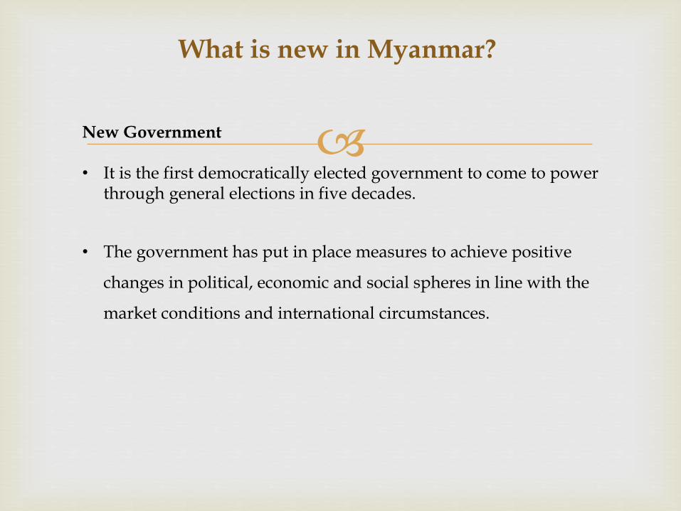
What is new in Myanmar?
New Government
• It is the first democratically elected government to come to power through general elections in five decades.
• The government has put in place measures to achieve positive
changes in political, economic and social spheres in line with the
market conditions and international circumstances.

New Political and Social Landscape
• In politics, although it cannot be said that political conflicts and
struggles for democracy that have been locked in many years of
stalemate have been resolved, cooperation on the common
grounds has become a possibility based on the concept of unity
in diversity.
• In the ethnic affairs, negotiations have been carried out with
almost all the nationality organisations that have been engaged
in armed insurrection for decades and most of them have
resulted in preliminary agreements and successes while some
racial strife remain and delay the reform process.
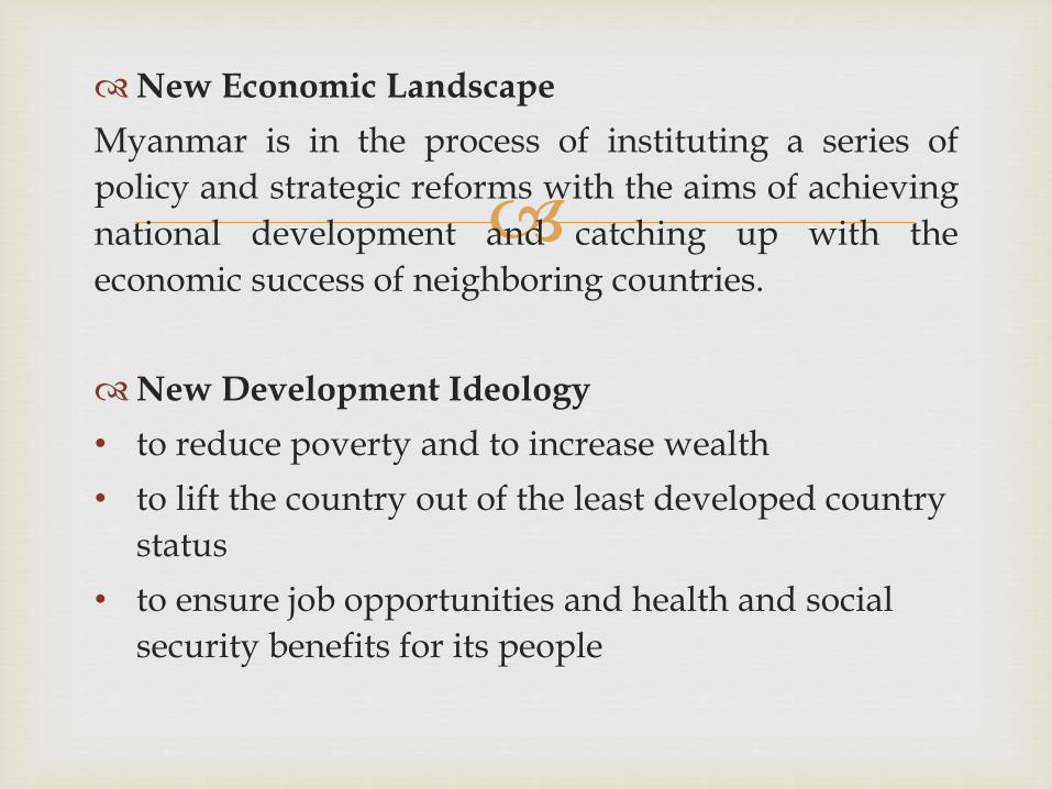
New Economic Landscape
Myanmar is in the process of instituting a series of
policy and strategic reforms with the aims of achieving
national development and catching up with the
economic success of neighboring countries.
New Development Ideology
• to reduce poverty and to increase wealth
• to lift the country out of the least developed country
status
• to ensure job opportunities and health and social
security benefits for its people

Goals of the Fifth Five-Year Plan (2011-12 to 2015-16)
• To achieve an average annual GDP growth rate of 7.7%
• To increase industrial share of GDP from 26% to 32%
together with an increase in the service sector, reducing
the currently high share of agriculture.
• To increase Per capita GDP growth between 30-40% from
the base year of 2010, which will help attain the first goal
of MDG in reducing the poverty incidence by half over the
period 2000-2015.
Source: MNPED
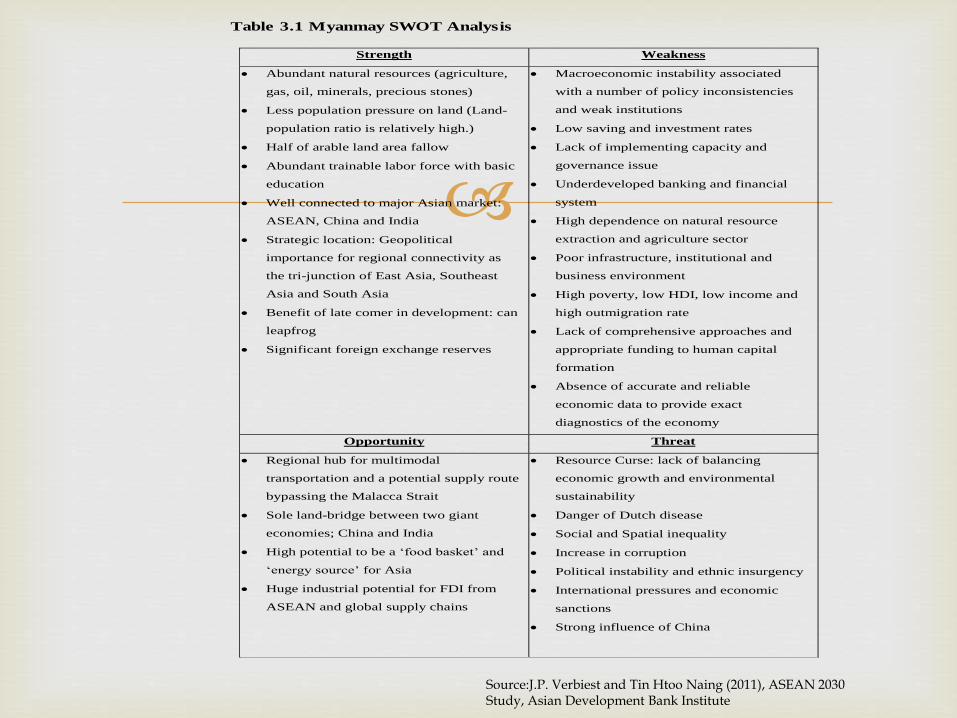
Table 3.1 Myanmay SWOT Analysis
Strength Weakness
Abundant natural resources (agriculture,
gas, oil, minerals, precious stones)
Less population pressure on land (Land-
population ratio is relatively high.)
Half of arable land area fallow
Abundant trainable labor force with basic
education
Well connected to major Asian market:
ASEAN, China and India
Strategic location: Geopolitical
importance for regional connectivity as
the tri-junction of East Asia, Southeast
Asia and South Asia
Benefit of late comer in development: can
leapfrog
Significant foreign exchange reserves
Macroeconomic instability associated
with a number of policy inconsistencies
and weak institutions
Low saving and investment rates
Lack of implementing capacity and
governance issue
Underdeveloped banking and financial
system
High dependence on natural resource
extraction and agriculture sector
Poor infrastructure, institutional and
business environment
High poverty, low HDI, low income and
high outmigration rate
Lack of comprehensive approaches and
appropriate funding to human capital
formation
Absence of accurate and reliable
economic data to provide exact
diagnostics of the economy
Opportunity Threat
Regional hub for multimodal
transportation and a potential supply route
bypassing the Malacca Strait
Sole land-bridge between two giant
economies; China and India
High potential to be a ‘food basket’ and
‘energy source’ for Asia
Huge industrial potential for FDI from
ASEAN and global supply chains
Resource Curse: lack of balancing
economic growth and environmental
sustainability
Danger of Dutch disease
Social and Spatial inequality
Increase in corruption
Political instability and ethnic insurgency
International pressures and economic
sanctions
Strong influence of China
Source:J.P. Verbiest and Tin Htoo Naing (2011), ASEAN 2030 Study, Asian Development Bank Institute
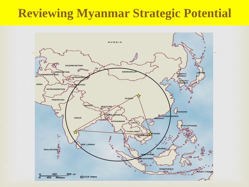
Reviewing Myanmar Strategic Potential
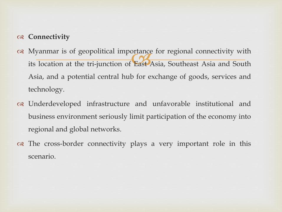
Connectivity
Myanmar is of geopolitical importance for regional connectivity with
its location at the tri-junction of East Asia, Southeast Asia and South
Asia, and a potential central hub for exchange of goods, services and
technology.
Underdeveloped infrastructure and unfavorable institutional and
business environment seriously limit participation of the economy into
regional and global networks.
The cross-border connectivity plays a very important role in this
scenario.

ASEAN, India and Chian Ranking on Logistics Performance Index, 2012
Country LPI Rank LPI Score Customs InfrastructureInternational
shipmentsLogistics
competenceTracking &
tracingTimeliness
Singapore 1 4.13 4.10 4.15 3.99 4.07 4.07 4.39
Hong Kong, China 2 4.12 3.97 4.12 4.18 4.08 4.09 4.28
China 26 3.52 3.25 3.61 3.46 3.47 3.52 3.80
Malaysia 29 3.49 3.28 3.43 3.40 3.45 3.54 3.86
Thailand 38 3.18 2.96 3.08 3.21 2.98 3.18 3.63
India 46 3.08 2.77 2.87 2.98 3.14 3.09 3.58
Philippines 52 3.02 2.62 2.80 2.97 3.14 3.30 3.30
Vietnam 53 3.00 2.65 2.68 3.14 2.68 3.16 3.64
Indonesia 59 2.94 2.53 2.54 2.97 2.85 3.12 3.61
Cambodia 101 2.56 2.30 2.20 2.61 2.50 2.77 2.95
Lao PDR 109 2.50 2.38 2.40 2.40 2.49 2.49 2.82
Myanmar 129 2.37 2.24 2.10 2.47 2.42 2.34 2.59
Source: World Bank 2013
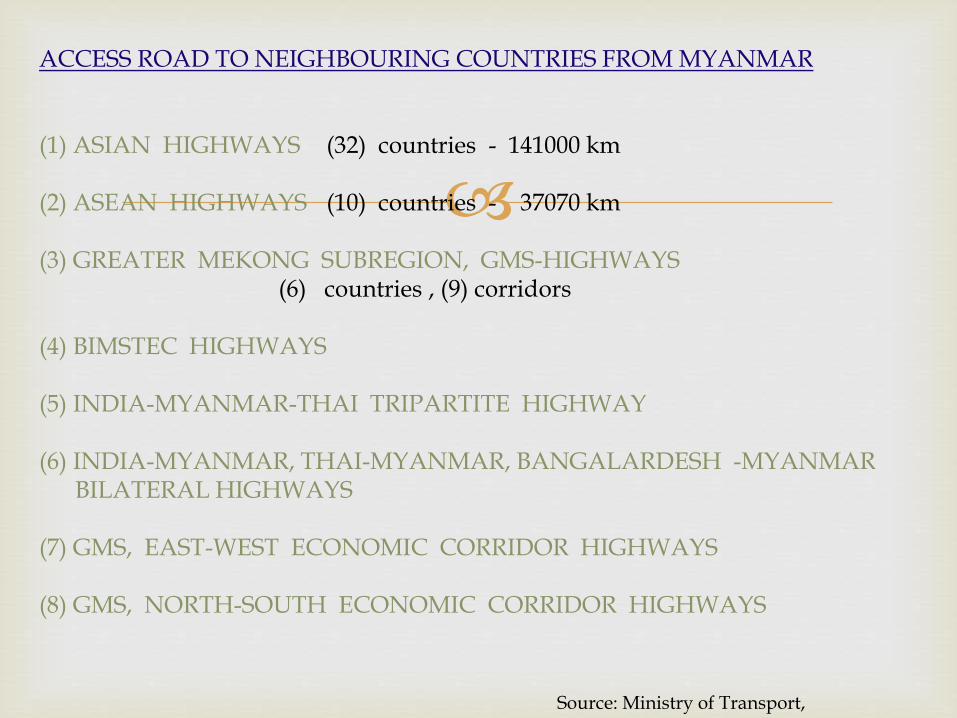
ACCESS ROAD TO NEIGHBOURING COUNTRIES FROM MYANMAR
(1) ASIAN HIGHWAYS (32) countries - 141000 km
(2) ASEAN HIGHWAYS (10) countries - 37070 km
(3) GREATER MEKONG SUBREGION, GMS-HIGHWAYS (6) countries , (9) corridors
(4) BIMSTEC HIGHWAYS
(5) INDIA-MYANMAR-THAI TRIPARTITE HIGHWAY
(6) INDIA-MYANMAR, THAI-MYANMAR, BANGALARDESH -MYANMARBILATERAL HIGHWAYS
(7) GMS, EAST-WEST ECONOMIC CORRIDOR HIGHWAYS
(8) GMS, NORTH-SOUTH ECONOMIC CORRIDOR HIGHWAYS
Source: Ministry of Transport, Myanmar

199220062015
GMS Connectivity:
Roads
Telecommunications
Power Transmission Line
Source: ADB

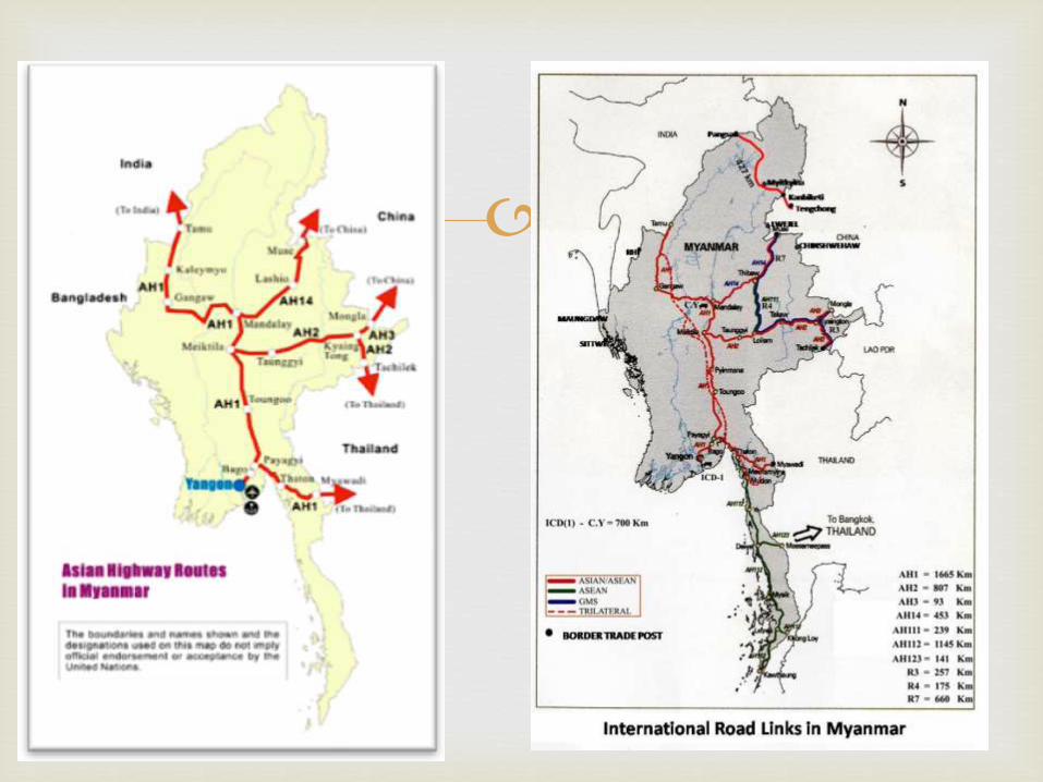
ASIAN Highways in Myanmar, AH1, AH2, AH3 and AH14, most of the
routes are either overlapping or contiguous with other Highways. Myawady
to Thingannyinaung of about (18)km is already upgraded to AH class III
Standard, with the Grant Aid of Thai Government.
Kyaikhto to Mandalay, including Payagyi-Yangon section of about 893 km is
already upgraded to AH standard with the Government budget and Private
sectors by B.O.T basis.
-The last section of Kalay/Kalewa to Tamu of about (150)km was
upgraded to the intermediate road class, with (5.5) meter carriageway width,
with the grant aid of India Government, still need to upgrade AH standard.
Current Status of Projects along Asian Highways
Ministry of Transports

• AH2 starts from Thai-Myanmar border cities of Maesai-Tachileik to meet
the AH1 at the city, Meiktila via Kyaington and is about (807)km.
-Tachileik to Kyaington section of about (164)km is upgraded to AH
class III standard by B.O.T.
-Kyaington to Meiktila section of about (643)km is under upgrading to
AH class III standard by Construction units from Public Works, MOC,
with Government budgets and (79)km is already upgraded .
• AH3 (93)km, the section between Kyaington and Mongla, the city at the
border of Myanmar and China, is upgraded to two lanes bituminous
paved road, but still need to improve to get AH class III standard.
• AH14 (453)km, with AH class III standard, is operated by B.O.T scheme.
Construction of new bridges and culverts in the places of old bridges
and culverts along the AH in accordance with the AH design loading.
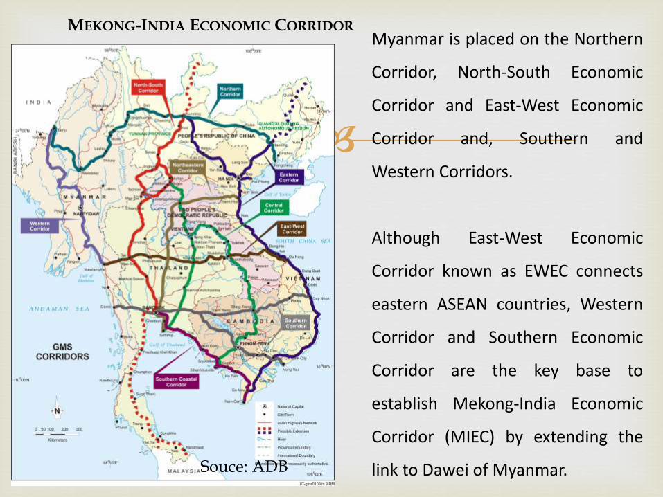
Myanmar is placed on the Northern
Corridor, North-South Economic
Corridor and East-West Economic
Corridor and, Southern and
Western Corridors.
Although East-West Economic
Corridor known as EWEC connects
eastern ASEAN countries, Western
Corridor and Southern Economic
Corridor are the key base to
establish Mekong-India Economic
Corridor (MIEC) by extending the
link to Dawei of Myanmar.
MEKONG-INDIA ECONOMIC CORRIDOR
Souce: ADB

India-Myanmar-Thailand Trilateral Highway project under the
Mekong-Ganga cooperation initiative that started in 2005 is also a
vital one to improve cross border connectivity between India and
Myanmar - 1360 km, US$ 700 million, runs from Moreh in India to
Maw Sot in Thailand through Bagan in Myanmar.
The road from Moreh to Mae Sot via Bagan includes part of East-West
Economic Corridor (EWEC) in Myanmar, particularly Myawaddy-
Mawlamyine section and part of No.1 Asian Highway (AH 1).
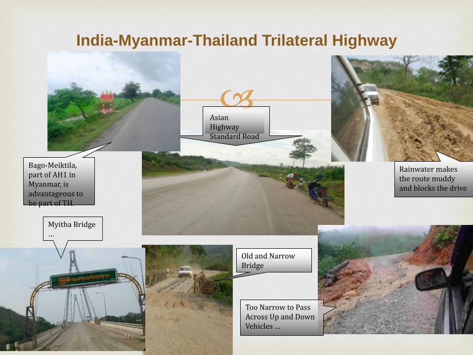
India-Myanmar-Thailand Trilateral Highway
Asian Highway Standard Road
Too Narrow to Pass Across Up and Down Vehicles …
Bago-Meiktila, part of AH1 in Myanmar, is advantageous to be part of TH.
Rainwater makes the route muddy and blocks the drive
Old and Narrow Bridge
Myitha Bridge …
Tiddim-Rhi-Falam road: Engineers and surveyors from Border Road
Organization of India and Public Works of Myanmar had prepared
detailed Project Report (DPR) of upgrading Tiddim-Rhi-Falam road
since 2006.
A technical team from India also visited to consult with the Myanmar
government with regards to the Tiddim-Rhi-Falam road upgrading
project in 2008.
Again, a delegation from two countries conducted a reconnaissance
survey in 2009 and India allocated USD 60 million for the respective
project.
At present, the draft MOU for the project is underway to realize the
upgrading project.
Kaladan Multimodal Transport Project: A major purpose is to
develop Sittwe port (Myanmar) by India Government for
supporting the cargo flow from Kolkata to Aizawl (Mizoran State,
India) through Kalandan river (Myanmar).
The project involves a major upgradation of infrastructure at
Sittwe, located about 250km from the Mizoram border on the
north-western coast of Myanmar where the Kaladan river joins
the Bay of Bengal (IPCS 2008).
The project will connect Kolkata seaport, East India with the
seaport in Sittwe (Arakan State) – a total distance of 539 km. It
will then link Sittwe to the landlocked area of Mizoram in
Northeastern India via Kaladan river and road transport.
M/S ESSAR Co.,Ltd (India) with Max Myanmar Construction Co., Ltd.
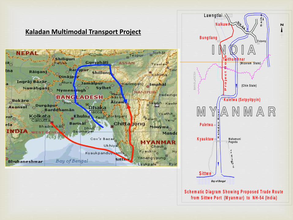
Kaladan Multimodal Transport Project
S c h e m a tic D ia g ra m S h o w in g P ro p o s e d T ra d e R o u te
fro m S it tw e P o r t (M y a n m a r ) to N H -5 4 ( In d ia )
K y a u k ta w
P a le tw a
K a le tw a (S e tp y itp y in )
S it tw e
Ka
la
da
n R
iv
er
M a h a m u n i
To
M
ra
uk
-U
P a g o d a
Pro
je
ct R
oa
d
L a w n g tla i
N a lk a w n
B u n g tla n g
T u ith u m h n a r
Sa
ih
a
T u ip a n g
(M iz o ra m S ta te )
(C h in S ta te )
NH
-5 4
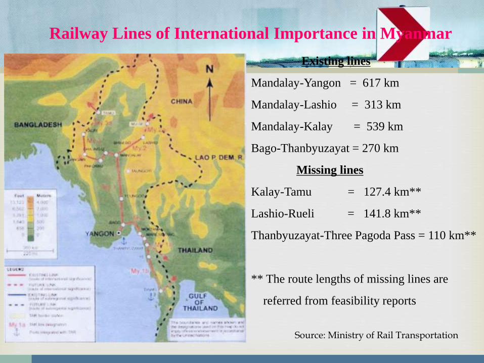
Railway Lines of International Importance in Myanmar
Existing lines
Mandalay-Yangon = 617 km
Mandalay-Lashio = 313 km
Mandalay-Kalay = 539 km
Bago-Thanbyuzayat = 270 km
Missing lines
Kalay-Tamu = 127.4 km**
Lashio-Rueli = 141.8 km**
Thanbyuzayat-Three Pagoda Pass = 110 km**
** The route lengths of missing lines are
referred from feasibility reports
Source: Ministry of Rail Transportation

Indian-Myanmar Rail link (Kalay-Tamu)
The missing length between
Kalay and Tamu is 127 Km in
Myanmar Territory. A survey team
from Rail India Technical and
Economics Services (RITES) had
made feasibility study for that link
in 2004.
Source: Ministry of Rail Transportation
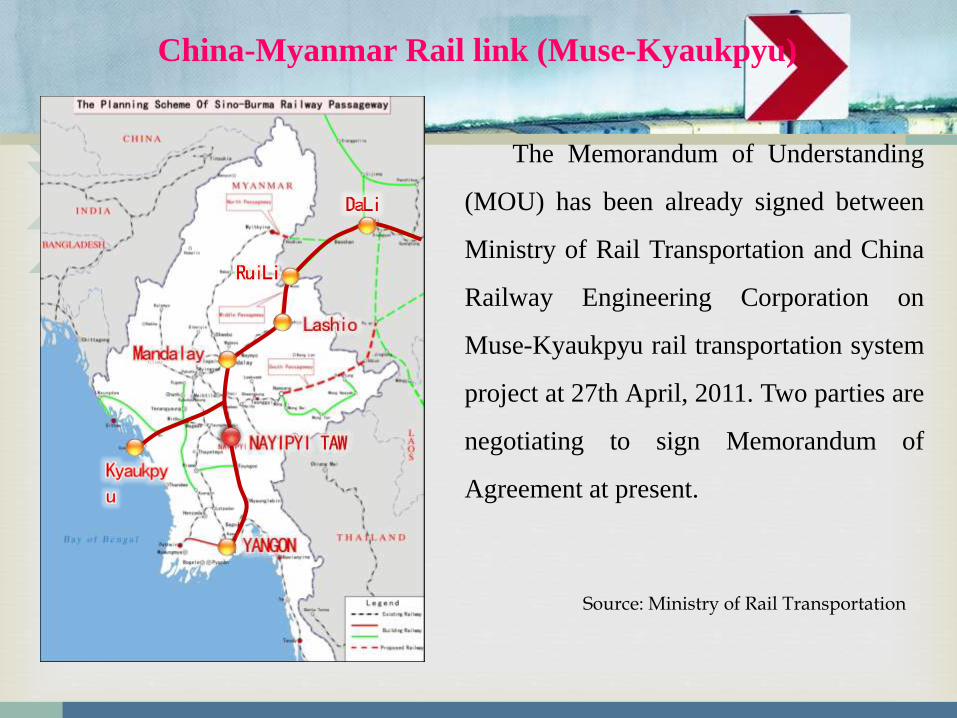
China-Myanmar Rail link (Muse-Kyaukpyu)
The Memorandum of Understanding
(MOU) has been already signed between
Ministry of Rail Transportation and China
Railway Engineering Corporation on
Muse-Kyaukpyu rail transportation system
project at 27th April, 2011. Two parties are
negotiating to sign Memorandum of
Agreement at present.
Source: Ministry of Rail Transportation
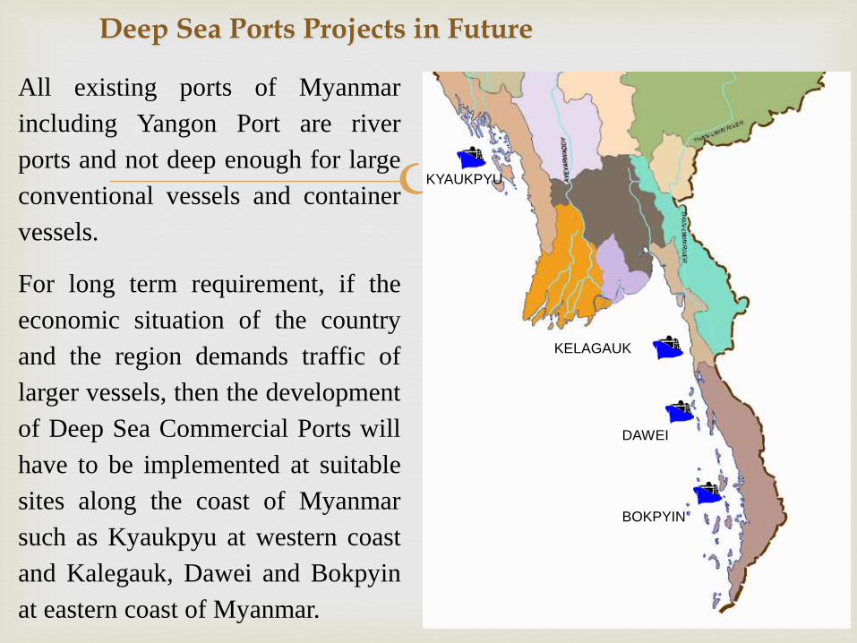
DAWEI
BOKPYIN
KYAUKPYU
KELAGAUK
All existing ports of Myanmar
including Yangon Port are river
ports and not deep enough for large
conventional vessels and container
vessels.
For long term requirement, if the
economic situation of the country
and the region demands traffic of
larger vessels, then the development
of Deep Sea Commercial Ports will
have to be implemented at suitable
sites along the coast of Myanmar
such as Kyaukpyu at western coast
and Kalegauk, Dawei and Bokpyin
at eastern coast of Myanmar.
Deep Sea Ports Projects in Future

SEZs
ThilawaSEZ
DaweiSEZ
KyaukphyuSEZ
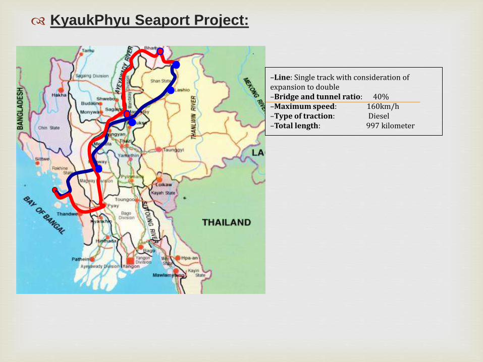
KyaukPhyu Seaport Project:
–Line: Single track with consideration of expansion to double–Bridge and tunnel ratio: 40%–Maximum speed: 160km/h–Type of traction: Diesel–Total length: 997 kilometer

2011 2040
Greater YangonPopulation Forecast
5,140,000
11,730,000
Source: MNPED
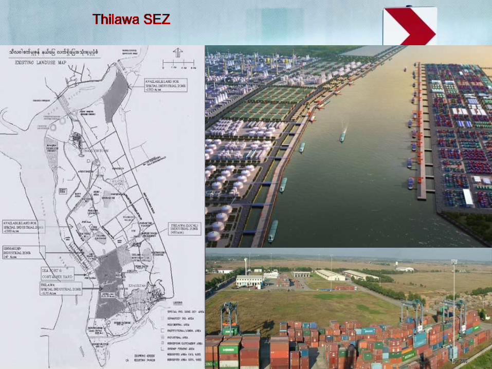
Development Framework - Thilawa SEZ
Source: YCDC
Increase Twice
Thilawa SEZMulti-purpose Development
- Manufacturing Area- Logistics Area- Commercial Area - Residential Area- Education Area etc.
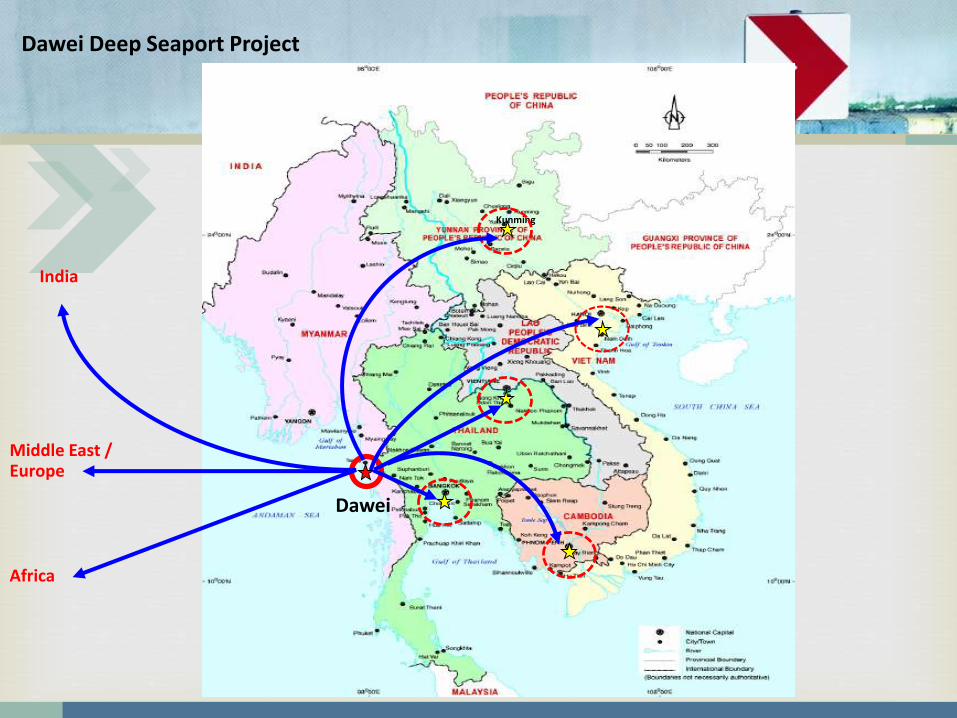
Dawei
Kunming
Africa
India
Middle East /Europe
Dawei Deep Seaport Project
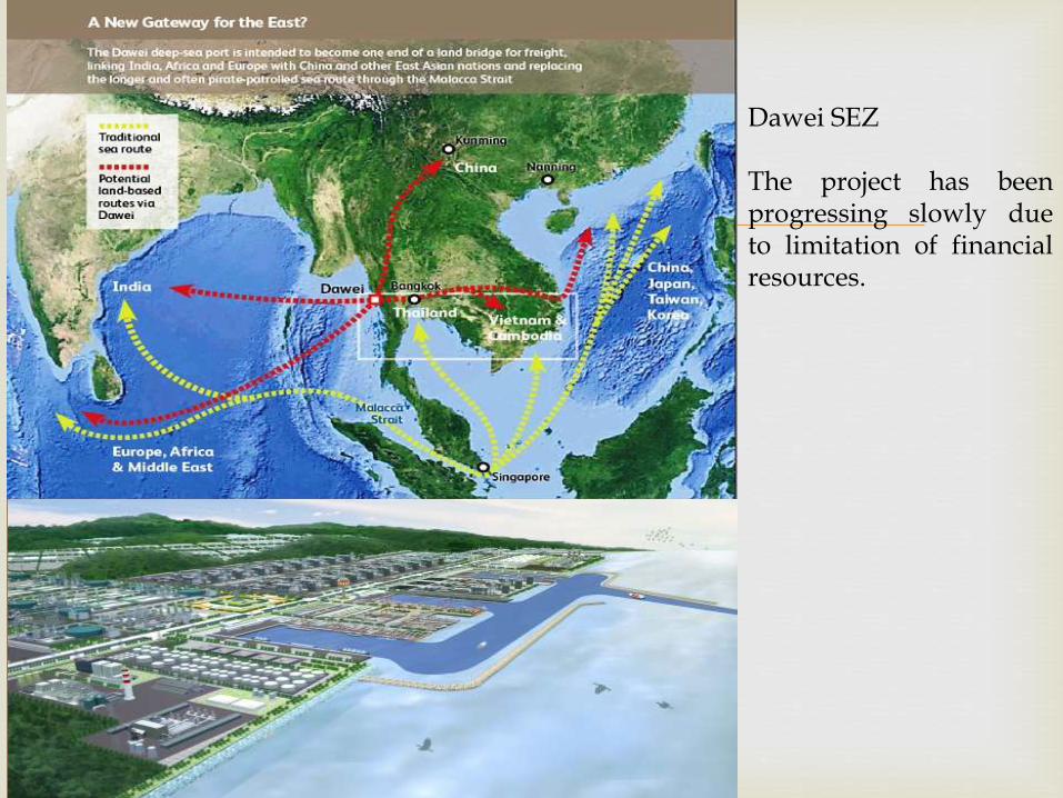
Dawei SEZ
The project has beenprogressing slowly dueto limitation of financialresources.
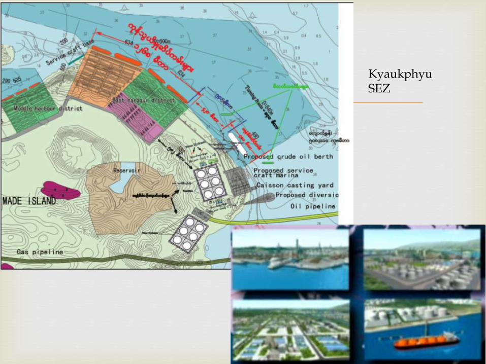
KyaukphyuSEZ
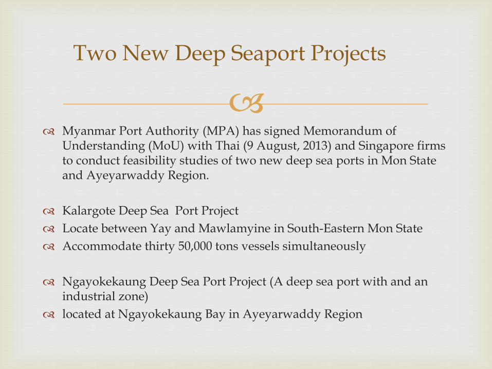
Myanmar Port Authority (MPA) has signed Memorandum of
Understanding (MoU) with Thai (9 August, 2013) and Singapore firms to conduct feasibility studies of two new deep sea ports in Mon State and Ayeyarwaddy Region.
Kalargote Deep Sea Port Project
Locate between Yay and Mawlamyine in South-Eastern Mon State
Accommodate thirty 50,000 tons vessels simultaneously
Ngayokekaung Deep Sea Port Project (A deep sea port with and an industrial zone)
located at Ngayokekaung Bay in Ayeyarwaddy Region
Two New Deep Seaport Projects

Conclusion
The connectivity projects will enhance the strategic importance of Myanmar as a
regional logistics and trading hub and will be definitely beneficial for Myanmar, India,
ASEAN and for the entire region.
India-Myanmar-ASEAN Connectivity could be realized through enhanced physical
infrastructure development, effective institutional arrangements and empowered people.
Building an enhanced regional connectivity requires not only the infrastructure
development but also the development of new strategies and institutions, more effective
implementation of existing and future initiatives (ADB 2010).
To realize the positive outcomes, Myanmar, India and ASEAN need to respond to the
opportunities offered by its geographical and natural advantages and to the competitive
advantages brought about by regional and global market chain.