

José Luis Ornelas de Anda, Instituto Nacional de Estadística y Geografía
47
IDENTIFYING GOOD PRACTICES IN ESTABLISHING NATIONAL DISASTER LOSS DATABASES MEXICO: PERSPECTIVE FROM THE NATIONAL STATISTICS AND MAPPING AGENCY Joint Expert Meeting on Disaster Loss Data 26th -28th October 2016, Paris, France
-
Upload
oecd-governance -
Category
Government & Nonprofit
-
view
44 -
download
0
Transcript of José Luis Ornelas de Anda, Instituto Nacional de Estadística y Geografía
IDENTIFYING GOOD PRACTICES IN ESTABLISHING
NATIONAL DISASTER LOSS DATABASES
MEXICO: PERSPECTIVE FROM THE NATIONAL STATISTICS
AND MAPPING AGENCY
Joint Expert Meeting on Disaster Loss Data
26th -28th October 2016, Paris, France

Background
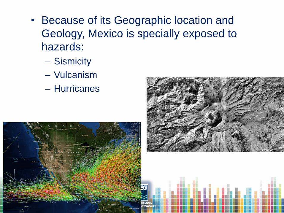
• Because of its Geographic location and
Geology, Mexico is specially exposed to
hazards:
– Sismicity
– Vulcanism
– Hurricanes
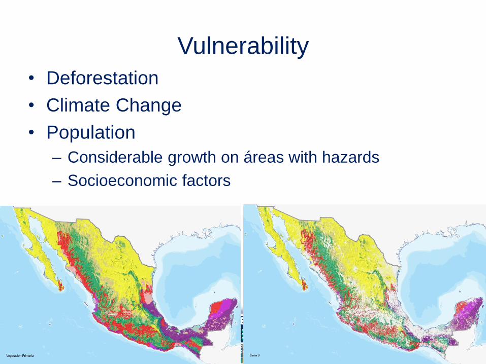
Vulnerability
• Deforestation
• Climate Change
• Population
– Considerable growth on áreas with hazards
– Socioeconomic factors
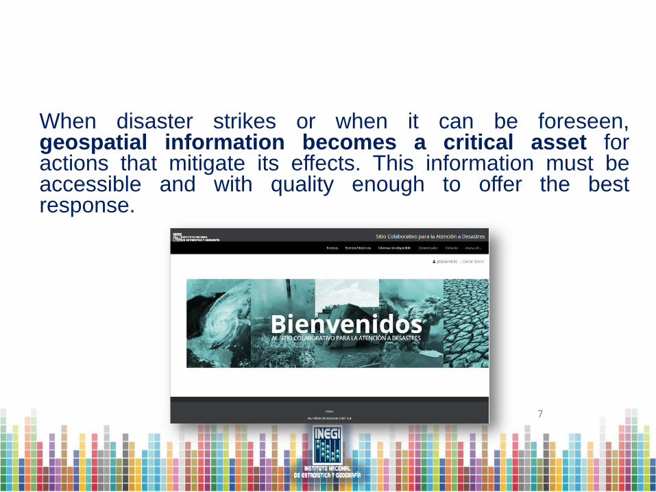
When disaster strikes or when it can be foreseen, geospatial information becomes a critical asset for actions that mitigate its effects. This information must be accessible and with quality enough to offer the best response.
7
Role of Geospatial Information
• INEGI operates a collaborative site in support of
Disaster / Emergency Management.
• Useful por planning, assessment
– Base Maps
• Topographic, DEMs, Hydrography
– Imagery; before, after
– Demographic data to block level
– DENUE (directory of economic units).
Collaborative site • INEGI has generated and shared information along several
decades for disaster/emergencies.
– Location and extent of damaged areas
– Mainly flooding after hurricanes
• Stan 2005
• Tabasco state floodings
– Earthquakes (Mexicali 2010).
• Aerial Photographies, up to 2010
– Flights for photography acquisition as soon as conditions allowed.
– Processing of film rolls
– Georreferencing of aerial photos
• Manual (precise, but very slow)
• Semiaútomatic (not accurate but very fast)
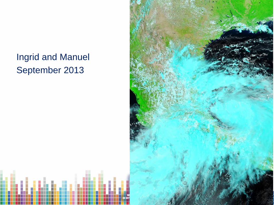
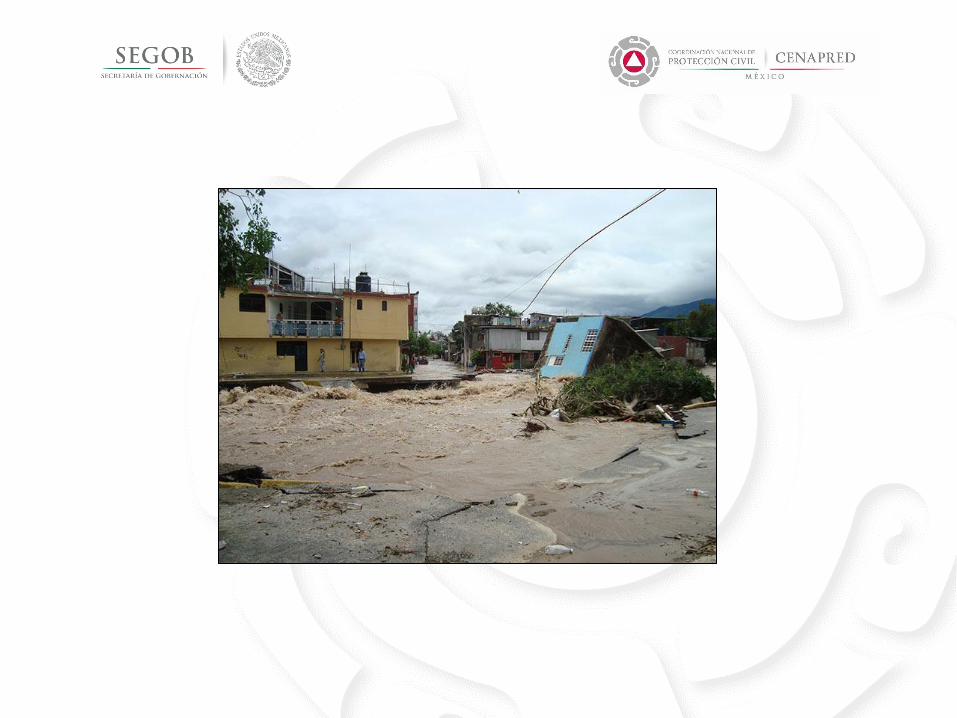
Ingrid and Manuel
September 2013
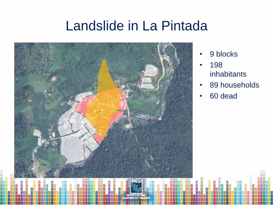
Landslide in La Pintada
• 9 blocks
• 198
inhabitants
• 89 households
• 60 dead
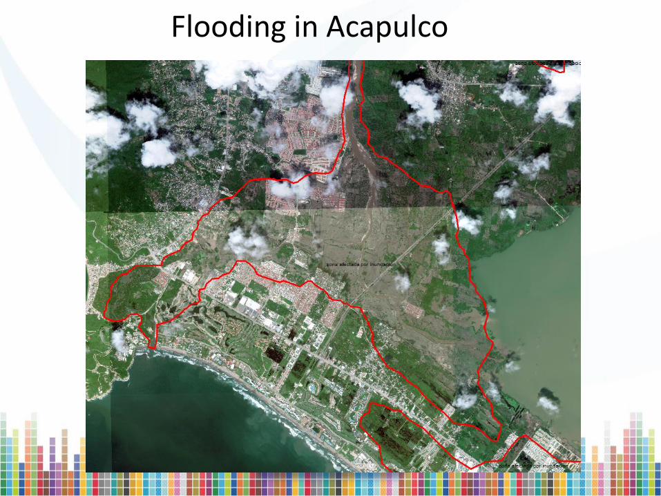
Flooding in Acapulco
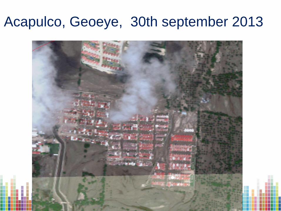
Acapulco, Geoeye, 30th september 2013
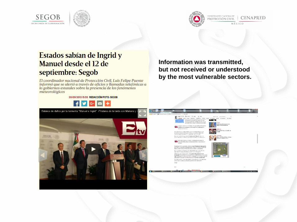
Information was transmitted,
but not received or understood
by the most vulnerable sectors.

Tornado; Piedras Negras, Coah.
May, 2015

Hurricane Patricia, 2015
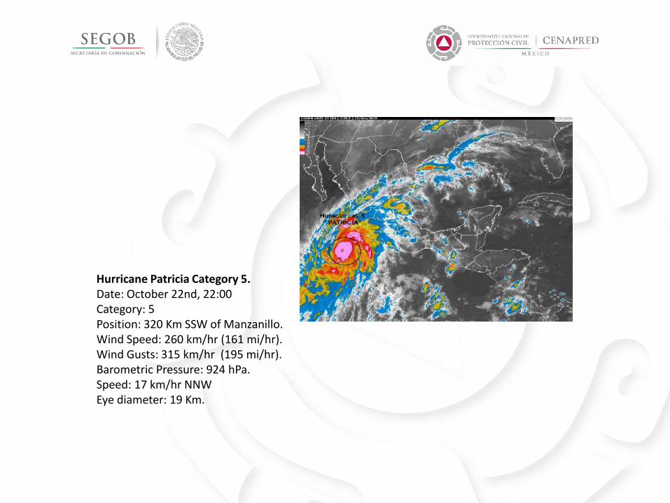
Hurricane Patricia Category 5. Date: October 22nd, 22:00 Category: 5 Position: 320 Km SSW of Manzanillo. Wind Speed: 260 km/hr (161 mi/hr). Wind Gusts: 315 km/hr (195 mi/hr). Barometric Pressure: 924 hPa. Speed: 17 km/hr NNW Eye diameter: 19 Km.
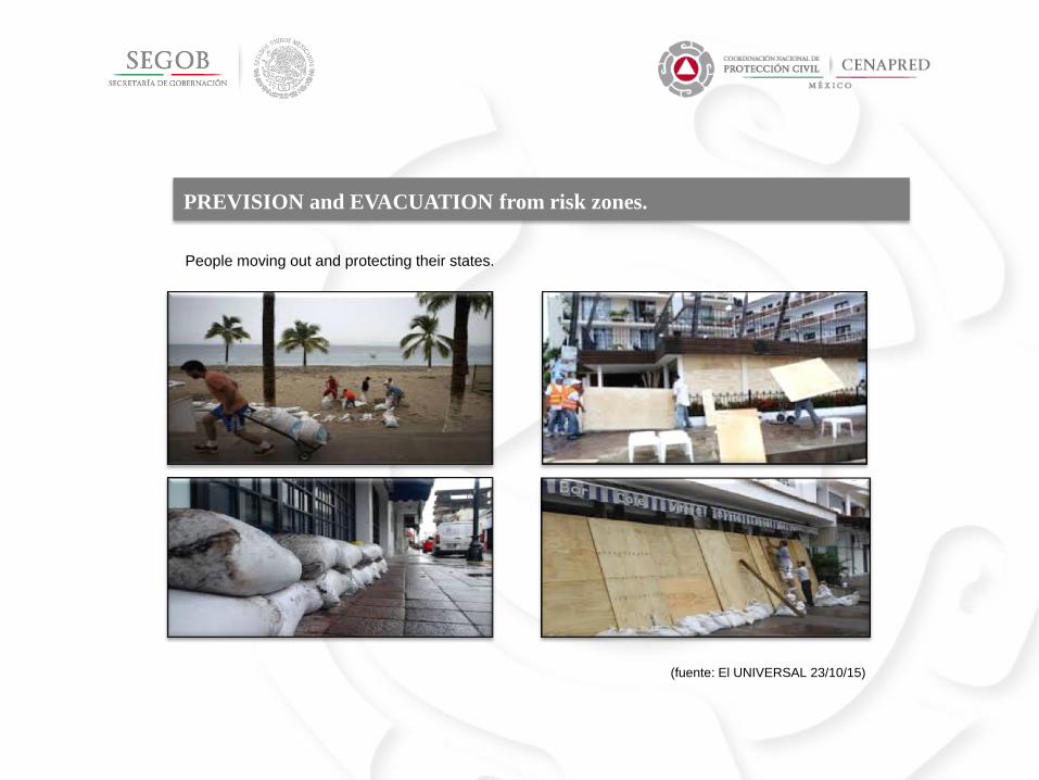
PREVISION and EVACUATION from risk zones.
People moving out and protecting their states.
(fuente: El UNIVERSAL 23/10/15)
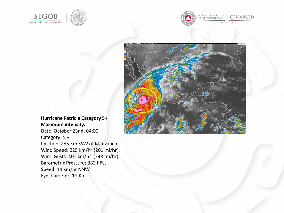
Hurricane Patricia Category 5+ Maximum intensity. Date: October 23nd, 04:00 Category: 5 + Position: 255 Km SSW of Manzanillo. Wind Speed: 325 km/hr (201 mi/hr). Wind Gusts: 400 km/hr (248 mi/hr). Barometric Pressure: 880 hPa. Speed: 19 km/hr NNW Eye diameter: 19 Km.
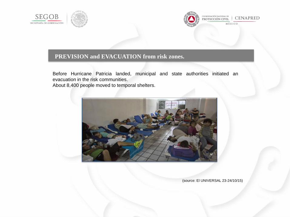
Before Hurricane Patricia landed, municipal and state authorities initiated an
evacuation in the risk communities.
About 8,400 people moved to temporal shelters.
(source: El UNIVERSAL 23-24/10/15)
PREVISION and EVACUATION from risk zones.
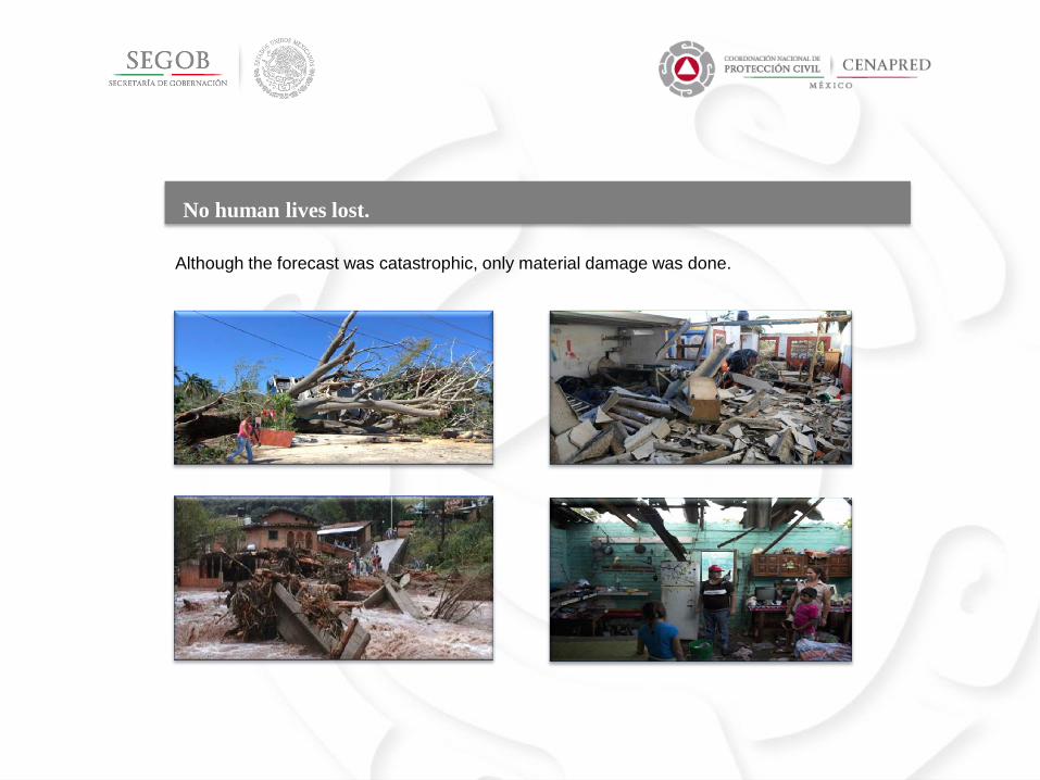
No human lives lost.
Although the forecast was catastrophic, only material damage was done.
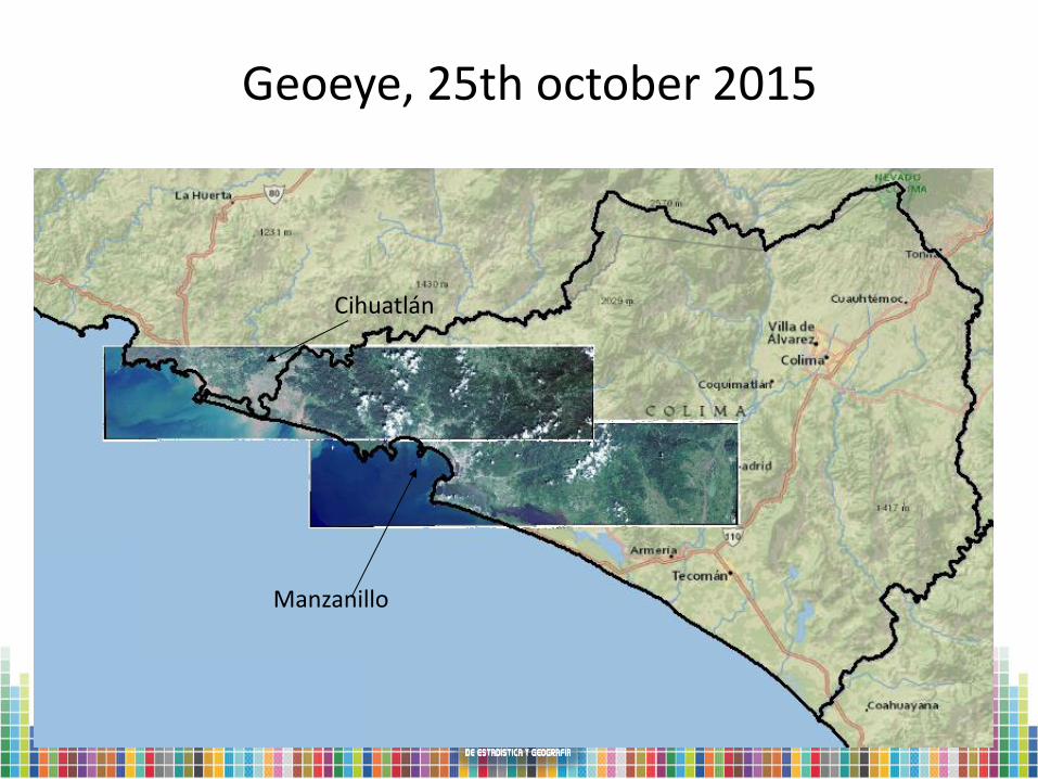
Geoeye, 25th october 2015
Cihuatlán
Manzanillo
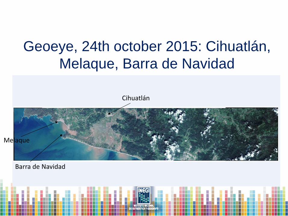
Geoeye, 24th october 2015: Cihuatlán,
Melaque, Barra de Navidad
Cihuatlán
Melaque
Barra de Navidad
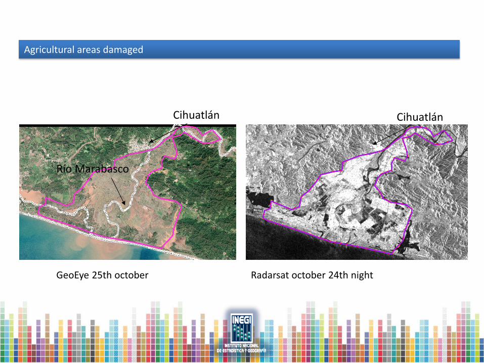
Agricultural areas damaged
GeoEye 25th october Radarsat october 24th night
Cihuatlán Cihuatlán
Río Marabasco
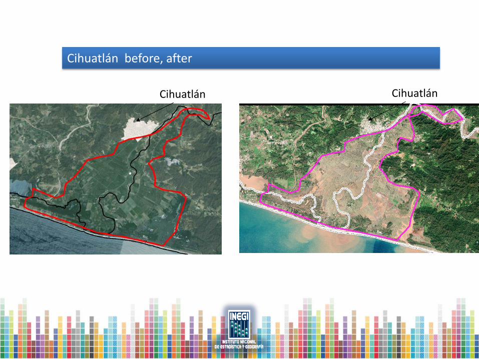
Cihuatlán before, after
Cihuatlán Cihuatlán
Explosion, Pajaritos Complex, April
2016
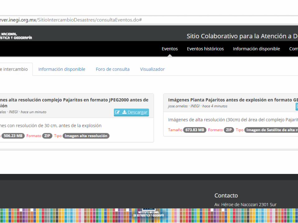
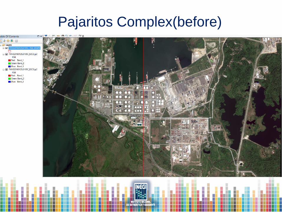
Pajaritos Complex(before)
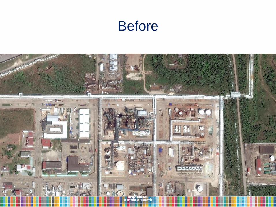
Before
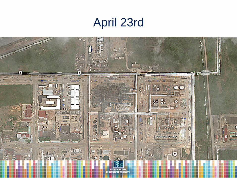
April 23rd
Summary
• Geospatial data is made available to agencies in
charge of disaster / emergency management.
– National Civil Protection
– National Center for Disaster Prevention
(CENAPRED).
– Army
– Navy
– Others
What about data losses?
• Information from INEGI is of great value as a
reference.
– Population and economic data
– Physical
– Imagery
• Other agencies assess and collect data
– National Electricity Commision
– Agricultural Ministry
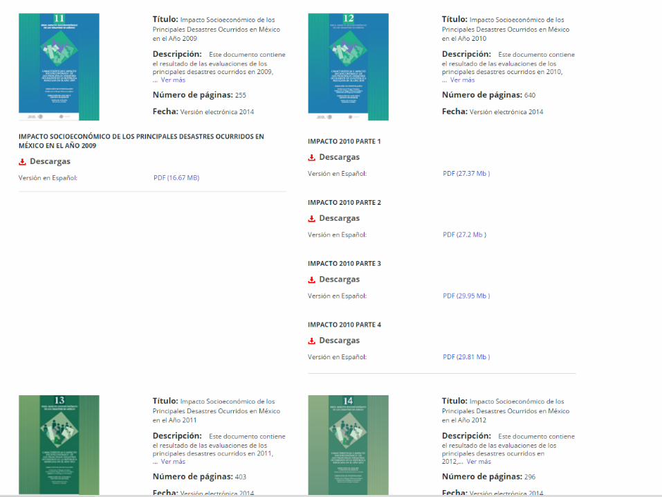
Data collection by CENAPRED
• It is part of SINAPROC, the National Civil
Protection System.
• National Risk Atlas
• Support before, during, after disasters
• Collect data in the field and from other agencies.
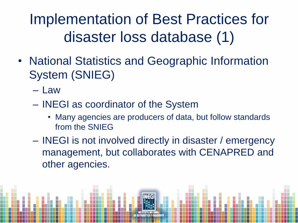
Implementation of Best Practices for
disaster loss database (1)
• National Statistics and Geographic Information
System (SNIEG)
– Law
– INEGI as coordinator of the System
• Many agencies are producers of data, but follow standards
from the SNIEG
– INEGI is not involved directly in disaster / emergency
management, but collaborates with CENAPRED and
other agencies.
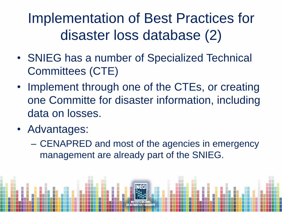
Implementation of Best Practices for
disaster loss database (2)
• SNIEG has a number of Specialized Technical
Committees (CTE)
• Implement through one of the CTEs, or creating
one Committe for disaster information, including
data on losses.
• Advantages:
– CENAPRED and most of the agencies in emergency
management are already part of the SNIEG.

Gracias!